Increasing efficiency for Germany's biggest pumping operation

“The cooperation with Landscape exceeded all our expectations. The results of the challenge are very promising and gaining insight in Machine Learning was valuable for future projects.”
— Isabelle, Geologist (mine water management) at RAG
After Germany stopped mining for coal, RAG became responsible for managing many of the mines that were now no longer in use. Their main activity consists of pumping tonnes of rainwater daily from these mines to prevent the mixing of mine water with drinking water.
Predicting the level of the water in the mines will enable RAG to plan their pumping operation more precisely, lowering costs.
But how do you predict the water level of centuries old mines, without maps, and without exact knowledge of the surrounding soil?
And even if you succeed in making predictions, how can you be certain that these predictions stay valid for long periods of time, as the pumping installations will have to be employed indefinitely?
Our solution: Explainable AI in action
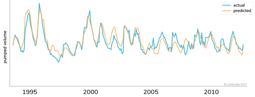
It was exactly to answer these questions that RAG employed the help of Landscape. During the pilot we predicted water levels in 3 mines by using a combination of geological maps, rainfall data, sensor data and more.
This neural network was able to predict the water level 8 weeks in advance in the mines with a 78-84% accuracy.

Next steps
The pilot proved that AI will improve the efficiency of RAG. It also gave RAG a first success in the field of data science. Future projects will refine the model, expand the scope to include all mines, and continue to use data to guide decision making.
Swier Heeres
Swier was principle data scientist on the RAG project. His background in Physics and Climate Science combined exceptionally well with his knowledge of neural networks and Explainable AI.